
What does perimeter actually mean? That is the first thing I want to know before setting off on the Oosterbeek Perimeter Route. The walk starts at Airborne Museum Hartenstein and takes me through a landscape where the history of the Battle of Arnhem is still visible and, at times, almost tangible.
A quick search gives me the answer: a perimeter is the boundary around a particular area. During the Battle of Arnhem in September 1944, the Perimeter was the horseshoe-shaped defensive line around Oosterbeek. British and Polish airborne troops had been forced back into this increasingly small area after heavy fighting.
The original aim of Operation Market Garden was to capture and hold several bridges across rivers and canals in the Netherlands. The bridge over the Rhine at Arnhem was a crucial link in that plan. Unfortunately, events did not unfold as intended. The Allied forces encountered much stronger German resistance than expected, and most of the troops were unable to reach the bridge at Arnhem.
The remaining British and Polish soldiers withdrew towards Oosterbeek. Here they formed a defensive line, with the Lower Rhine creating a natural boundary on its southern side.

The Oosterbeek Perimeter was the defensive line around the area that remained in Allied hands during the Battle of Arnhem.
Now that I understand the name, I am ready to start walking. Later, during my visit to the museum, an impressive digital presentation will make the whole story even clearer. But first, it is time to explore the route itself.
I start the Oosterbeek Perimeter Route at Airborne Museum Hartenstein. I will save the museum visit for later. It deserves plenty of time and I want to share that experience in a separate blog. For now, I am heading outside.
Although the walking route is less than ten kilometres long, my progress slows almost immediately. There is simply too much to photograph. Before I have even properly started, Oosterbeek is already telling me its stories.
The route is shaped like a figure eight, just like the Drop Zone Route in Ede. I first walk through the green surroundings behind the museum, heading towards the Lower Rhine.


It is not long before I hear running water. The sound is so inviting that, naturally, I have to investigate.
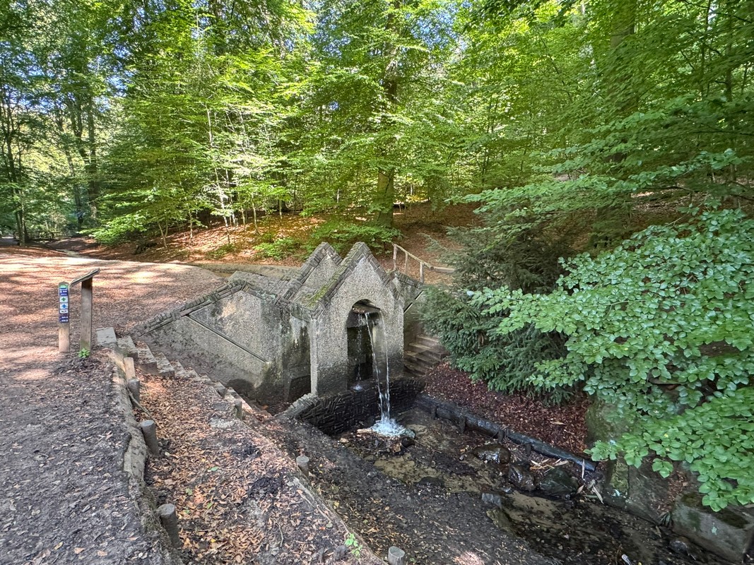
I find a stream with a small waterfall. Water flows down between stone walls, creating the sound that caught my attention. It feels wonderfully peaceful. That is not necessarily what I expected from a walk so closely connected to wartime history.
A little farther along the path, I come across a small grotto house. It has nothing to do with the Second World War, but it is still worth stopping for. Water plays a role here too, so this is a place to listen as well as look.
As I continue, I notice a long pipe carrying water. It falls from a considerable height into the stream below. Once again, my curiosity takes over and I walk across to read the information board.
It turns out that a sugar factory once stood here. The flowing water was used to power its waterwheel.
This is exactly what I love about walking. Something small catches your eye, you become curious and, before you know it, you have discovered a piece of local history that you might otherwise have passed without noticing.


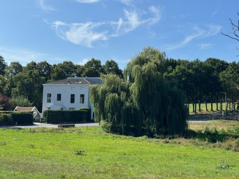
Back on the route, a beautiful old weeping willow catches my attention.
I immediately wonder whether the tree survived the war. I do not know its exact age, of course, but the thought that it may already have stood here while fierce fighting surrounded Oosterbeek in 1944 makes it feel special.
Today, I am walking through a peaceful landscape. In September 1944, the reality here could hardly have been more different.
An information panel from Liberation Route Europe gives me more insight into the fighting that took place here.
The battle around Oosterbeek was intense. The Allied troops had very little time to dig in and create a defensive line. The Lower Rhine formed the natural southern boundary of the Perimeter.
It feels strange to look at the surroundings now. I am walking peacefully through the same landscape where soldiers fought, wounded men were treated and people did everything they could to survive.
The scenery gradually changes. The paths become narrower and the river appears between the trees. This is a beautiful section of the Oosterbeek Perimeter Route.
But because I now know more about its history, I look at the river differently. During the Battle of Arnhem, the Lower Rhine was not simply a beautiful view. It formed the natural boundary of the Perimeter and eventually became the escape route for the remaining Allied soldiers.
After nine days of fighting, the evacuation across the Lower Rhine took place during the night of 25 to 26 September 1944. Around 2,400 soldiers managed to reach the southern bank. I am now walking beside that same river, trying to imagine what that night must have been like.
In another blog, I will walk on the opposite side of the river and follow the story of the Polish troops at Driel.
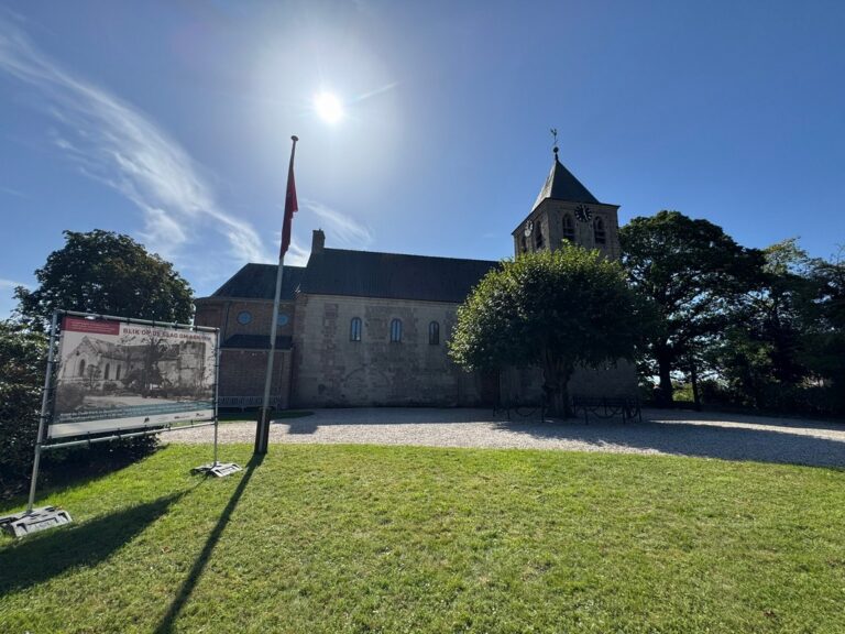
The narrow paths overlooking the Lower Rhine eventually take me back towards the edge of Oosterbeek. Here I pass the Old Church, known locally as the Oude Kerk.
I will return to this location when I walk the White Ribbon Mile. The church was one of the southernmost positions within the Oosterbeek Perimeter and played an important role during the Battle of Arnhem. The church and its surroundings stood in the middle of the fighting and suffered severe damage.
As the walk continues, I increasingly feel that the history of Oosterbeek is not hidden behind a museum door.
It is outside. Along the walking trails, beside the river, between the trees and in the middle of the village.
Shortly before returning to Airborne Museum Hartenstein, I pass De Tafelberg. Despite its name, this is not a hill or a natural landmark but a building. The information here immediately takes me back to September 1944.
Before the Battle of Arnhem, De Tafelberg was a hotel. During Operation Market Garden, it was given a completely different role and became one of the main medical posts within the Perimeter.
Hotel guests were replaced by wounded soldiers. Operations were performed in conditions that were far from ideal. When shelling caused ceilings to collapse and the usual rooms could no longer be used safely, the medical teams had to improvise.
One detail on the information panel is almost impossible to imagine:
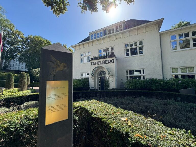
Stretchers were placed on billiard tables so that the medical teams could continue operating on wounded soldiers.
Do not ask me how they managed it, but that is what the information at De Tafelberg tells me.
A hotel in the middle of a battle zone had been transformed into an improvised field hospital. Details like this stay with me far longer than dates and names alone.
Perhaps that is exactly why I find this route so fascinating. In less than ten kilometres, you encounter small pieces of a much larger story.
And I have not even entered the museum yet.
Back at the museum, I start the shorter loop of the figure-eight route. This section mainly takes me through the built-up area of Oosterbeek.
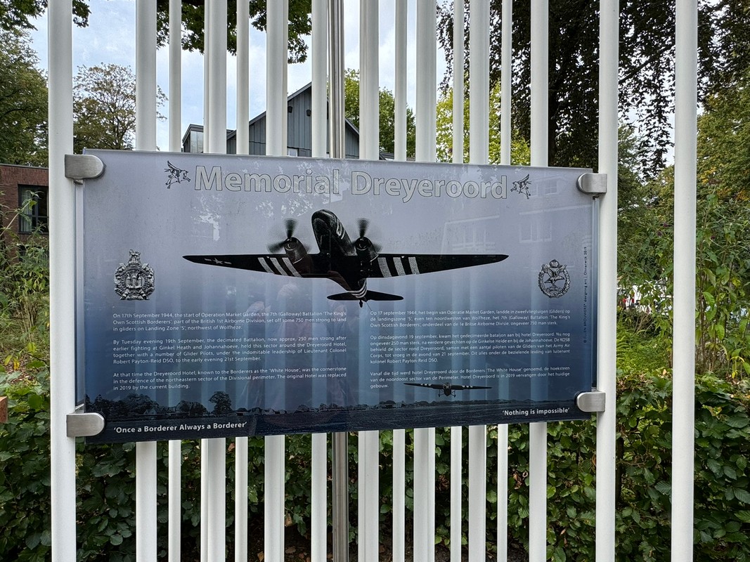
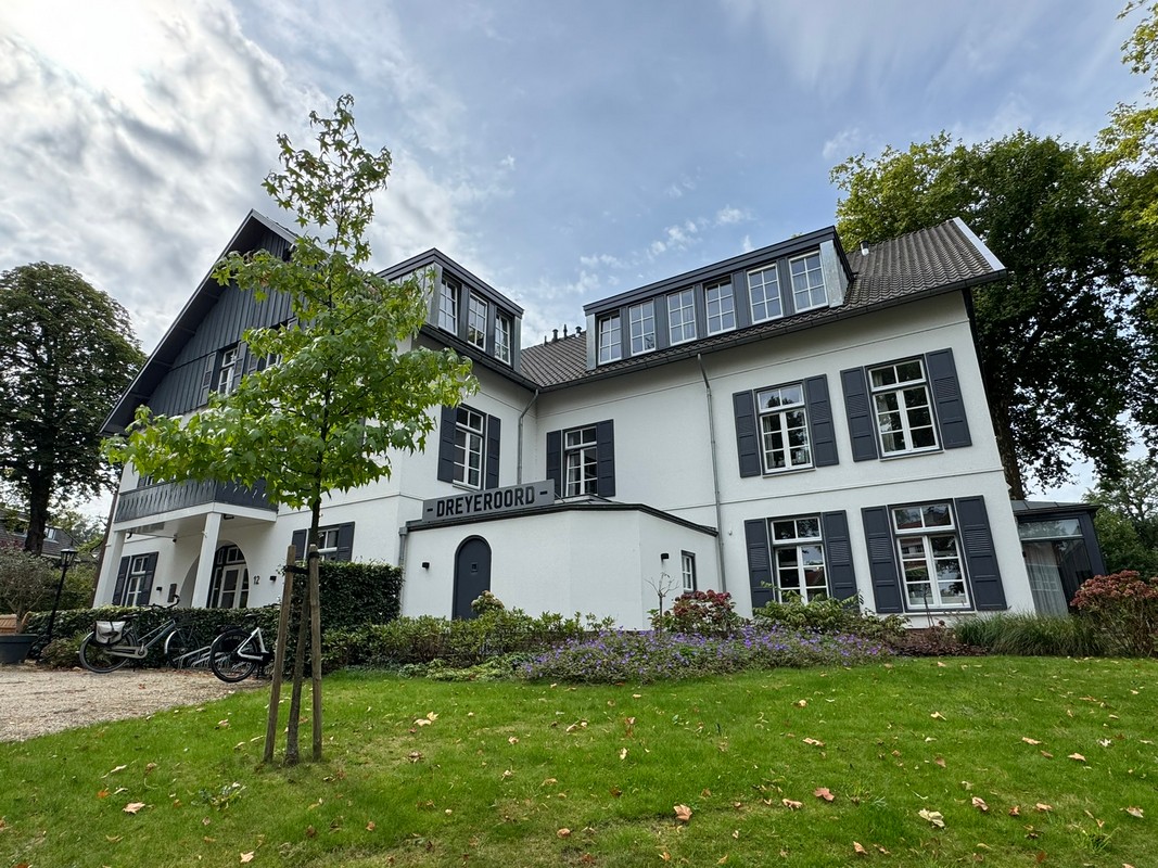
My first stop is Dreyeroord. The original hotel no longer stands here, but the present building has retained the name. A colourful memorial tells the story of the fierce fighting that took place at this location.
The memorial rests on 24 tubes, representing the average age of the soldiers who were killed. The cables in the design symbolise the tow ropes of the gliders used to bring airborne troops to the Netherlands.
I love how elements whose meaning is not immediately obvious can be so carefully considered.
I continue walking and spot another information panel. Just as I am about to read it, an older gentleman approaches. He is out for a walk with his dachshund, who is travelling comfortably in a little cart.
The man notices me looking at the panel and turns back.
Pointing towards a group of bushes, he tells me that British soldiers had been lying concealed there while German tanks thundered past. We talk for a little longer. He tells me that he also served in the military after the war and was part of the medical staff.
There is something special about not only reading history on an information panel but also hearing a story from someone you meet while walking.

There is only a short distance left before I reach the end of the route. Information posts stand outside several residential properties. Each house had its own role or significance during the Battle of Arnhem. They are all worth stopping to read.
Back at Airborne Museum Hartenstein, I finish my walking day.
The Oosterbeek Perimeter Route is not a walk you complete simply to count the kilometres. It shows how nature, village life and wartime history are deeply intertwined here. You walk past flowing water and old trees, but also visit places where soldiers fought, wounded men were treated and remarkable stories unfolded.
I will visit the museum when I return to walk the White Ribbon Mile. One thing is already clear: Oosterbeek still has many more stories to tell.
What is the Oosterbeek Perimeter Route?
The Oosterbeek Perimeter Route is a historical walking route through and around Oosterbeek in the Netherlands. It follows locations connected to the horseshoe-shaped Allied defensive line formed during the Battle of Arnhem in September 1944.
Where does the Oosterbeek Perimeter Route start?
The walk starts at Airborne Museum Hartenstein in Oosterbeek. Hartenstein served as the headquarters of British Major-General Roy Urquhart during the Battle of Arnhem.
How long is the Perimeter Route in Oosterbeek?
The official route is approximately 9.1 kilometres long and has the shape of a figure eight. This makes it possible to divide the walk into two separate loops.
Which historical places can you see along the route?
Important locations include Airborne Museum Hartenstein, the Lower Rhine, the Old Church, De Tafelberg and Dreyeroord. Information panels and memorials explain the role these places played during the Battle of Arnhem.
Is the route only interesting for military history enthusiasts?
No. The route also includes woodland paths, streams, views across the Lower Rhine and local industrial history. It combines nature, village scenery and stories from the Second World War.

Starting point: Airborne Museum Hartenstein, Utrechtseweg 232, Oosterbeek
Distance: The official route is approximately 9.1 kilometres long. It is shaped like a figure eight and consists of two loops.
What you will see: The route passes several important locations connected to the Battle of Arnhem, including Airborne Museum Hartenstein, the Lower Rhine, the Old Church, De Tafelberg and Dreyeroord.
My tip: Take the time to read the information panels and memorials along the way. Without their stories, you might simply walk past houses, woodland and village streets. Once you understand what happened at these locations in September 1944, you begin to see the entire landscape differently.
Take your time: Although the route is only about 9.1 kilometres long, allow more time than you normally would for a walk of this distance. There is a great deal to read, see and photograph along the way.
Combine the walk with the museum: Airborne Museum Hartenstein is the starting point of the route and tells the story of the Battle of Arnhem. If you want to walk the route and visit the museum on the same day, allow several hours for the complete experience.
Good to know: Parts of the route follow woodland paths and narrow trails near the Lower Rhine, while other sections pass through the streets of Oosterbeek. Wear comfortable walking shoes and take extra care when the paths are wet.
Plan your visit: Before travelling to Oosterbeek, check the official Airborne Museum Hartenstein website for current opening hours, admission prices, accessibility and travel information.