
The Netherlands is known for its flat landscape, but there are two areas where the hills rise higher. Near Nijmegen – Groesbeek (Gelderland) and in South Limburg, you’ll find rolling hills that almost seem to challenge the mountains. Particularly in South Limburg, close to the borders with Belgium and Germany, the landscape offers unexpected elevation changes and breathtaking views.
In celebration of the 10th anniversary of the Dutch Mountain Film Festival, the Dutch Mountain Trail was created in 2020. This roughly 100-kilometer route takes you through the rugged and non-Dutch landscape of Limburg, from east to west. A true challenge for hikers looking for adventure, with steep climbs, panoramic views, and a raw connection with nature.
The trail connects seven mountain peaks, known as the Seven Summits, each offering a unique perspective on the surrounding landscape. The route is officially divided into four stages, but as with any hike, you can adjust it to suit your needs.
The trail begins at Eygelshoven station (Kerkrade) and ends at Maastricht station. Along the way, you’ll experience South Limburg’s rolling hills in all their beauty: babbling brooks, steep rock formations, endless vistas, and most importantly, peace and space to breathe in nature deeply.
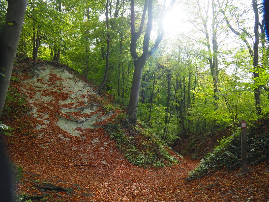
From Eygelshoven station, you immediately step into the lush green landscape. The paths wind through hills, dipping into deep valleys and passing by fast-flowing streams. Along the Strijthagerbeek, you can admire the steep banks from above, where crystal-clear water flows through a narrow bed. When the sun filters through the trees, the light dances on the water, making you feel like you’ve stepped into another country, far from flat Holland.
Your first climb is the Wilhelminaberg, a man-made hill that, at 225 meters, feels surprisingly impressive. From the summit, you’re rewarded with panoramic views over the surrounding landscape, where nature and the region’s mining history blend seamlessly.


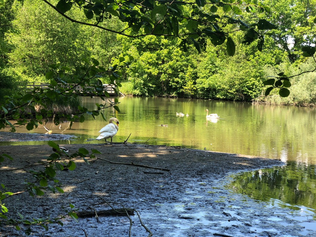
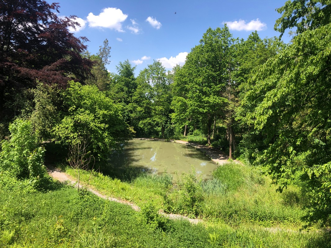
After descending, you pass the beautiful Erenstein Castle, surrounded by sprawling gardens full of blooming flowers and impressive statues. Time seems to stand still here. You continue along streams and boardwalks towards the second peak of the day, the Schneeberg, nestled in the German forest. The rocky, forested paths challenge hikers with their ruggedness.
Along the way, you’ll pass the iconic Miljoenenlijntje, a steam train route whose name comes from the high cost of its construction. The smell of steam and coal fills the air as the train chugs through the rolling landscape. Just before reaching the summit, you walk through the quiet, historical remnants of the Westwall, where time seems frozen since World War II.

In this stage, you climb the paths of the Vaalserberg, home to the famous Three-Country Point. Here, the borders of the Netherlands, Belgium, and Germany meet, and if you stop for a moment, you can feel the wind blowing from three different directions. The view from the Vaalserberg is spectacular, with rolling fields stretching as far as the eye can see. The silence and vastness of the landscape bring a deep sense of calm.
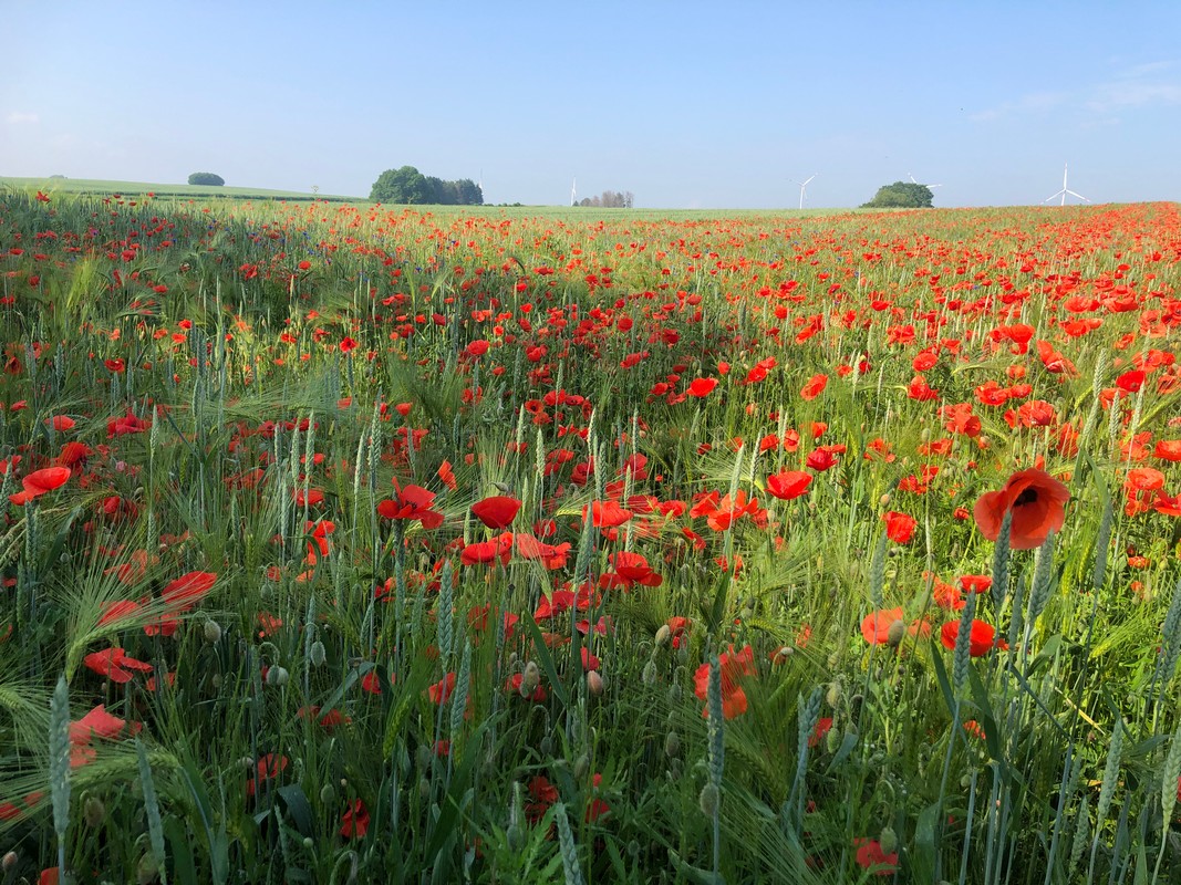
Before reaching the first summit of the day, the Eyserberg, you pass through Vijlen, the highest village in the Netherlands. Here, the landscape looks like a living painting, with hills full of vineyards and grain fields. In the distance, the silhouettes of distant villages and forests stand out against the horizon, and the scent of grapes fills the air.
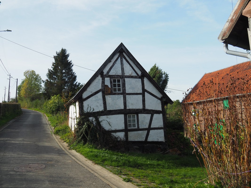
The trail continues along narrow paths, with each turn revealing a new view, until you finally descend into Gulpen, a picturesque village nestled in the hills.


This stage offers an abundance of nature, from lush vineyards to tranquil streams. The climb to the Gulperberg is challenging, but the reward at the top is the impressive Mary Statue, which suddenly emerges from the mist. When I walked here, the statue was shrouded in a mysterious fog, making the experience even more magical. This Marian monument has stood here since 1935, offering a serene resting place in the middle of nature.


You continue toward the Hakkenberg, walking through quiet forests and deserted hollow roads. The crunch of leaves beneath your feet and the smell of damp moss bring you fully into the moment. Before you know it, you’re standing on the edge of Teuvenderberg nature reserve, gazing across the valley into Belgium. The view over the village of Teuven and its old railway bridge gives you that ultimate vacation feeling.
The third summit of the day, Kattenroth, is hidden between trees and fields, marking the last peak before you finish the stage in the charming village of Mheer.


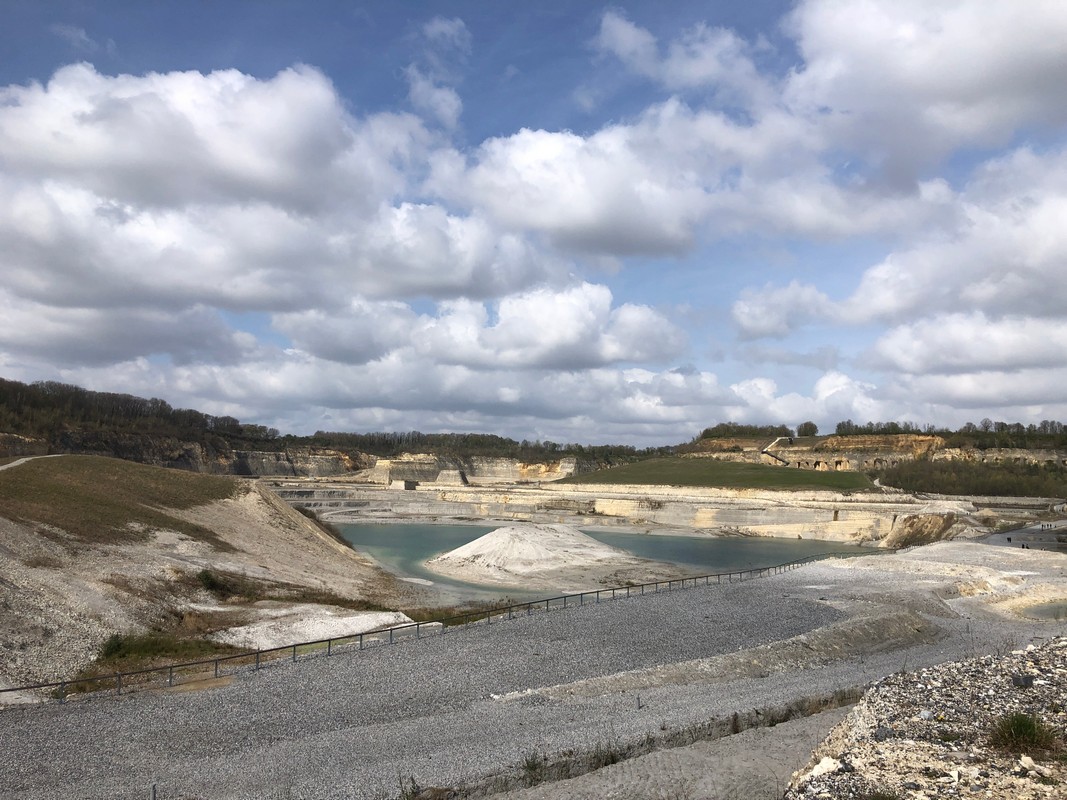
The final stage takes you along the Meuse River, where the river flows lazily through the landscape. The air is thick with the smell of grass and water, and the wind carries the salty scent of the river. The only summit of the day, D’n Observant, offers a breathtaking view over the Meuse Valley and the impressive ENCI Quarry, where the blue water contrasts sharply with the chalk-white walls of the quarry.
The walk through the ENCI Quarry is an experience in itself: the desolation of the place, the cliffs, and the azure water give it an almost otherworldly feel. You continue towards Maastricht, where the city gates welcome you. The city, with its old streets, cozy squares, and historic buildings, is the perfect ending to an unforgettable hike through South Limburg’s rugged landscape.


Below are all the stages, kilometers and Summits as described in the hiking guide
Eygelshoven – Vaals Wilhelminaberg (225 m) en Schneeberg (257 m) |
Vaals – Gulpen Eyserberg (197 m) |
Gulpen – Mheer Gulperberg (157 m), Hakkenberg (252 m) en de Kattenroth (209 m) |
Mheer – Station Maastricht D’n Observant (157 m) |
28
|
23
|
26
|
24
|
Our Photos
We take photos with our phone, mirrorless camera, or compact camera. We don’t edit our experience photos with colors or filters; all the colors you see are exactly as we observed them.
A Walking Pin
Would you like a walking pin as a souvenir of this hiking route? You can click here.
Other Hikes
If you’d like to read more about our hikes, check out our overview page.
Route – GPS
For all information about the stages, the hiking guide (in Dutch), or the GPS route, visit this website.
Subscribe to our newsletters and miss no promotions, new collections or blogs!